

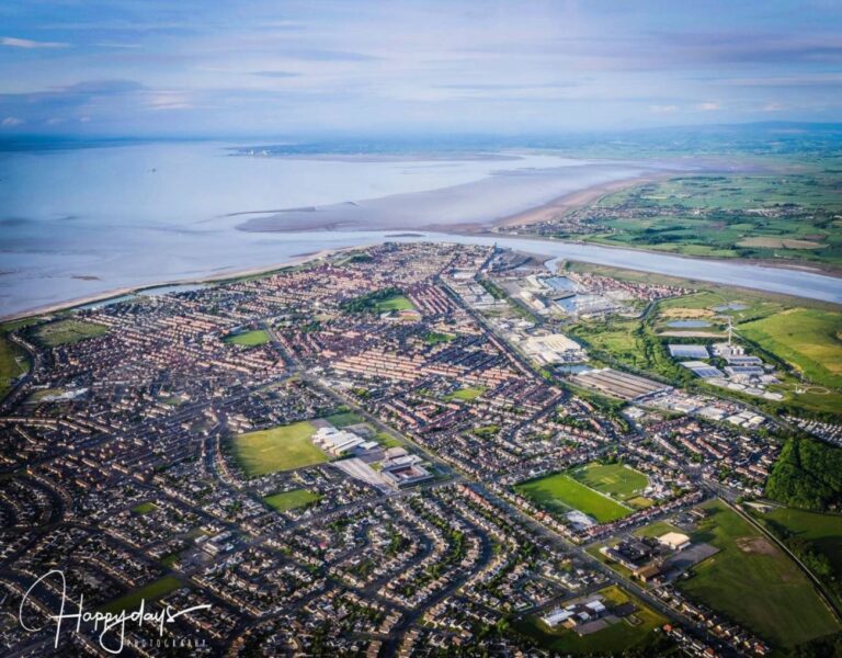
The River Wyre flows through Lancashire to join the Irish Sea at Fleetwood. It forms the northern, top edge of the Fylde Coast, where the vast expanse of Morecambe Bay begins. Pictured above: The mouth of the River Wyre at Fleetwood. Photo by Mark McNeill, Happy Days Photography
The River Wyre is around 28 miles long (or 45km in new money). It slowly continues through the County before it reaches Fleetwood and enters the Irish Sea. As you’d expect, the river is a very diverse place, serving different needs along its course.
Did you know? It’s the only one of the major Lancashire rivers to flow entirely in Lancashire. (The Ribble begins in Yorkshire and the Lune in Cumbria).
The river is a County Biological Heritage Site (BHS), the catchment area draining into it about 175 square miles. (More about BHS below)
It’s name dates back to pre-Roman times, and our River Wyre shares its name with others of the same name elsewhere in the UK. A Celtic meaning is possibly ‘winding river’. As it forms where Tarnbrook Wyre and Marshaw Wyre converge, that’s probably where its name ‘River Wyre’ comes from.
The River Wyre at Fleetwood
Standing on Ferry Beach at The Esplanade, it’s not easy to see where the River Wyre begins and ends! At high tide it’s indiscernible from the Irish Sea – on the surface. Underwater the currents are immensely strong.
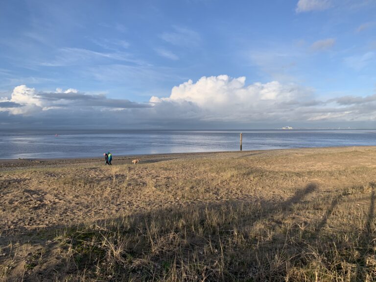
At low tide you can see the channel of the river, as it snakes and turns through the sandbanks before making its way past Fleetwood RNLI and Coastguard station and heading inland.
FREE Newsletter
FREE Newsletter

Please DON’T go walking out into the bay. It’s a very dangerous place – don’t underestimate it.
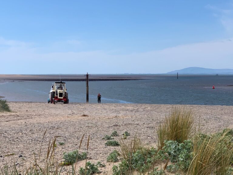
Join us in this walk, filmed in June 2020, from Queens Terrace to The Esplanade, looking over the river –

Enjoyed this video? Why don’t you subscribe to the Visit Fylde Coast YouTube channel, for loads more great content!
The River Wyre from Source to Sea
Up in the hills, two separate tributaries, Tarnbrook Wyre and Marshaw Wyre, feed the river. It begins in the Forest of Bowland near the village of Abbeystead, running south through Dolphinholme.
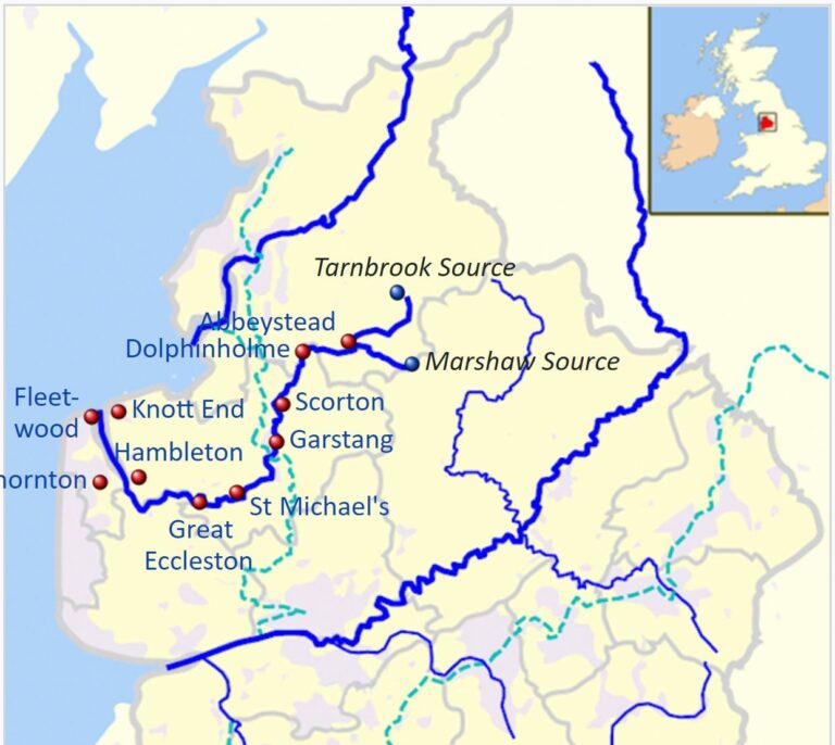
💦 The Lancaster Canal crosses the Wyre as it flows through Garstang, carried on an aqueduct.
💦 At Catterall, a mile south of Garstang, it meets the River Calder. After turning west to flow through the pretty village of St Michaels on Wyre it’s joined by the River Brock.
💦 The River Wyre becomes tidal below the weir at St Michaels. It’s got about another 13 miles to flow from this point, to reach the coast at Fleetwood.
💦 Between Little Eccleston and Out Rawcliffe is a toll bridge at Cartford, where you can cross the river. It’s usually a nominal 50p fee.
Crossing the River Wyre
You might be familiar with Shard Bridge – just off the main A585 road to Singleton and the M55. The original, iron bridge was built in 1864 and for much of that time was also a toll bridge. It’s now free to cross after the new, concrete replacement bridge was built in 1993, a little further upstream.

Bustling Ports & Country Parks
💦 Skippool is just a little way along the river from Shard Bridge. If you’ve never been it’s well worth a visit. Now a quaint and old fashioned boat lovers paradise, it was once the major trading port of the area.
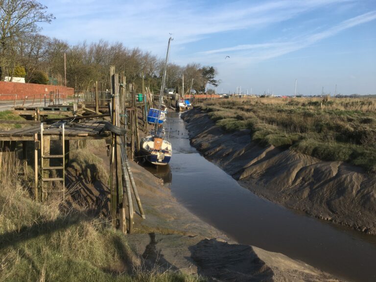
💦 And not far from Skippool is Wyre Estuary Country Park. Access it via the streets of Thornton. It’s a lovely spot beside the river bank where you’ll also find a cafe, toilets and parking. Here you can enjoy the wildlife and views as you walk alongside the river.

Enjoyed this video? Why don’t you subscribe to the Visit Fylde Coast YouTube channel, for loads more great content!
Industrial Past and Present
The estuary and seaward end of the River Wyre was once a hub of major industrial activity with the salt and alkali works at Burn Naze. Now called Hillhouse International Enterprise Zone the site is still home to various industrial businesses.
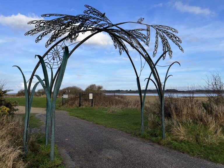
💦 But it’s not quite at the sea just yet! After passing Wyre Estuary Country Park, the river then detours past Fleetwood Marsh Nature Park. Set at the side of Hillhouse Enterprise Zone it’s best accessed by car via Jamieson Road – just off Eros roundabout on the A585.
Fishing and Trade
The geography of this river and the sheltered estuary made it an ideal fishing port for our ancestors. Built between 1869 and 1877, Wyre Dock is now the site of Affinity Lancashire – the Freeport Fleetwood shopping village.

Ferry Crossing
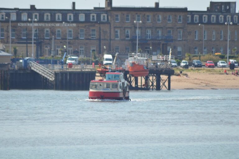
Other than driving around the countryside lanes, the alternative way to cross the River Wyre is via the Fleetwood to Knott End ferry. It’s a really useful form of transport – and also a must-do for visitors!
Safe Navigation
Fleetwood is famous for its three lighthouses. Two are really obvious, but the third is harder to spot! Together, these three structures lined up to give vessels safe passage along the channel of the River Wyre.

What’s a Biological Heritage Site?
Biological Heritage Sites (BHS) are ‘local wildlife sites’ in Lancashire, identified with published guidelines.
Biological Heritage Site status is important because:
- Important sites can be identified, audited and recorded.
- The natural environment of sites is taken into account when considering planning applications. And, BHS status improves proactive conservation by both the public/voluntary groups and landowners.
Some of this information is from Wikipedia. There’s a full list of the tributaries into the River and settlements alongside at this link.
While you’re here…
Go to the homepage of the Visit Fleetwood website for the latest updates.
Love the Fylde Coast? Sign up for your email newsletter. Packed full of interesting things it arrives in your inbox all 52 weeks of the year.
Join us on Facebook at our Visit Fylde Coast Facebook Group and follow us on Twitter @visitFyldeCoast
Plus hundreds of videos to watch on our YouTube channel – from all over the Fylde Coast!
Booking a stay? Pick a safe, clean and legal place to stay, at the very best price. Book with the Visit Fylde Coast and StayBlackpool guide.

We Need Your Help
We Need Your Help


