

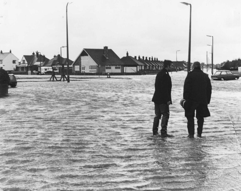
Over the years, the Irish Sea has succeeded in causing flooding in Fleetwood a number of times. After each flood event, improvements to the sea defences have followed.
Take a look at these old photos* of flooding in Fleetwood. Do you remember any of these incidents? Have you got any photos to add? Leave a comment below or email your photos to jane@theRabbitPatch.co.uk
Christmas 1924
This must have been some Christmas gift – deep flood water across the town in 1924. Ben Nuttall contacted us, saying “I’ve been scanning some old family photos and thought you might like to include these”. Thanks Ben!


Flooding in Fleetwood in 1927
Devastating floods hit Fleetwood on the nights of 28 & 29 October 1927. A force 12 wind combined with a 33’6″ tide combined to create a 2000 acre lake around the town, cutting it off for five days.
More than 1,800 properties, the homes of 10,000 people, became inundated with sea water. Six people drowned in the Fylde area – five of them were in Fleetwood. Three were gypsies living in the ‘Peel Road colony’. At the time it was the worst flood that the Fylde Coast had ever experienced.


The Perfect Storm
It was what you might call a ‘perfect storm’. The winds were gale force 12, reaching 80mph. The 33′ tide was about seven feet higher than predicted. Most of the town was under seawater following this flooding in Fleetwood in 1977. Two miles of railway track were submerged under six feet of sea water. The electricity works were flooded and stopped working.
Take a look at this old British Pathe film clip of the floods of 1927.
FREE Newsletter
FREE Newsletter


Drafted in to help was a fleet of small rowing boats, many of them borrowed from Stanley Park lake. The boats ferried supplies to the hundreds of people stranded at home, while they were unable to get out. The Mayor of Leeds even sent a convoy of trucks with emergency supplies.
The deep water persisted for three days before it started to subside. In the doorway of the Strawberry Gardens pub on Poulton Road there’s an engraved line marking the height reached by the water. It reads ‘Height of Flood 29 Oct 1927’.
The devastation left behind when the water did subside was tremendous. There were dead animals – both pets and farm animals – washed down from flooded farmland Over Wyre. Stranded high and dry was everything the water had carried along. Just dumped and left behind. With lots of silt, sand and sludge for good measure.
Blackout in Fleetwood
The flooding obviously affected public services, effectively cutting the town off. The whole town was pitched into darkness when the electricity works were flooded. The duration of the disaster exhausted supplies of oil, candles and any other means of light and heat.
Fleetwood became entirely cut off during the three days of the flood. Not a tram, bus or car came in or out of the town. All of the underground telephone and communication cables were out of action.
Help from the country
It was national newspaper The Times who came to the towns rescue. They reported on the disaster and sent out a rallying cry to the country to help.
Charles Saer, Chairman of Fleetwood Council, opened The Fleetwood Disaster Fund along with Lord Stanley. He made a donation of £200 to start the fund. There was even a contribution from Buckingham Palace!
Have you got any more photos of flooding in Fleetwood?
We’d love to share them. Please get in touch!
Just email your photos to jane@theRabbitPatch.co.uk
Not quite sure what the relevance of the next photo is… but we’ve included it anyway!

Repairing the Sea Defences
We were given the next old photo as construction of the new Rossall Sea Defences began. It’s a fascinating image, full of old machinery, old working practices and a complete lack of health and safety at work!

On the reverse is some text, presumably written by someone at Wyre Borough Council:
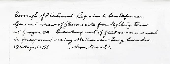
“Borough of Fleetwood, repairs to sea defences.
“General view of Gleesons site from lighting tower at Groyne 2A. Breaking out of fill re-commenced in foreground using the Kiernan-Terry Breaker.
“12 August 1955. Contract 1”
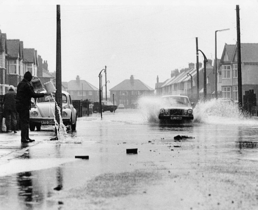
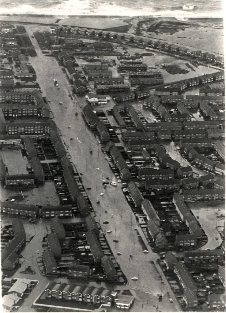
Flooding in Fleetwood in 1977
On 11 and 12 November 1977, Fleetwood and the Fylde Coast suffered another serious flooding event. The wind was Force 10 – gusting as high as Force 12. Sea levels reached 6.2m and caused extensive overtopping from the sea.

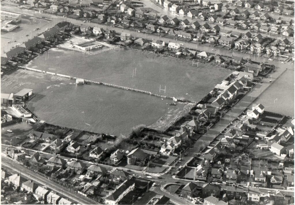
Blackpool, Knott End and Pilling were badly affected, as were Crossens and Haverigg. In total around 5000 properties saw some flooding, with almost 2000 of them inundated with more than 1m of water. 7,900 acres of farmland were flooded, along with so many swamped homes.

Fleetwood Underwater
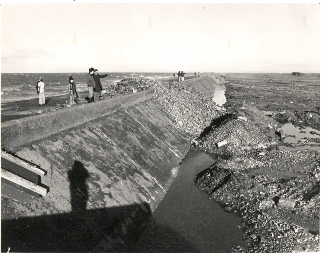
Parts of the sea wall crumbled under the might of the Irish Sea, causing widespread devastation. Sadly, at that time there was no way of warning people in advance. The whole of the seafront, from Rossall School to the Sea Cadets base, was under water.


Flood water always carries debris with it, and this debris had blocked the drains. With no way for the flood water to escape, streets remained under water the following day.


*These photos are from a variety of sources. All are widely circulated online and are in the public domain.
This is an interesting video, made of still photos from the Lancashire County Council drainage department –

New Sea Defences After Flooding in Fleetwood
River or sea defences generally see substantial improvements, not long after flooding events. Not just here in Fleetwood, but all over the country. There’s a pattern all along this coast, from Fleetwood to Lytham, where flooding has led to sea walls being built or strengthened.
The big, concrete sea wall (known from the other side as the ‘Berlin Wall’) was constructed at Rossall after the 1977 floods. Along the seafront at Fairway – as far as the golf course. It’s this very sea wall which has just been rebuilt during the 2018 Rossall Coastal Defence Project. See more photos of the old sea wall at the link, and find out how the new wall was built.

While you’re here…
Go to the homepage of the Visit Fleetwood website for the latest updates.
Love the Fylde Coast? Sign up for your email newsletter. Packed full of interesting things it arrives in your inbox all 52 weeks of the year.
Join us on Facebook at our Visit Fylde Coast Facebook Group and follow us on Twitter @visitFyldeCoast
Plus hundreds of videos to watch on our YouTube channel – from all over the Fylde Coast!
Booking a stay? Pick a safe, clean and legal place to stay, at the very best price. Book with the Visit Fylde Coast and StayBlackpool guide.

We Need Your Help
We Need Your Help


I must commend you on an excellent article about the flooding of Fleetwood in 1927 and 1977. I have often wonder why there were not more photos available showing the extent of the 1927 flooding and was pleased that you found the Pathe news clip covering the incident. I seem to remember that there used to be a marker on the outside of the Strawberry Gardens hotel on Poulton road showing how high the flood water reached at that location, I don’t know if it is still there. I had moved away from Fleetwood by 1977 so do not have any recollections of that flooding which made the photos you showed of that time very enlightening to me regarding the extent of the damage.
As a construction materials engineer I was very interested in your photos of the sea defence construction at different time periods in the history of the Fylde coast, amazing amount of work was done,very impressive. I had to smile at your comment regarding the lack of health and safety present at the construction site in 1955, how things have changed now. Although living in the Manchester area now I made several trips to Rossall during the latest modifications to the sea defences and was very impressed with the scale of the task. I t would have been an added bonus to your article if you could have extended the article to include even more detail regarding the damage to the town and surrounding areas, maybe in another article?
Thank you Eric – I’ll see if I can dig out anything else!